About project
Customer

The Krasnodar municipality.
Krasnodar is a city and the administrative centre of the Krasnodar region, Russia, located on the Kuban River.
Krasnodar is the economic centre of southern Russia. For several years, Forbes magazine named Krasnodar the best city for business in the country. The industrial sector of the city has more than 130 large and medium-sized enterprises.
Krasnodar is a highly developed commercial area and has the largest annual turnover in the Southern Federal District of Russia. Per capita, the city has the highest number of malls in the country. Note that in the crisis year 2009 turnover of Krasnodar continued to grow, while most of the cities showed a negative trend in the sale of goods.
Goal
The goal is to provide immediate access to information on city infrastructure and hazardous facilities with mapped locations, as well as to identify facilities that would be impacted in the event of an accident.
Challenge
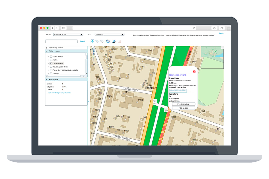
The most complicated task was to create software for map and facility location visualization without the usage of any external geo-service or commercial software.
Tasks
To create an intranet GIS working with no internet connection or access to external geo-services.
To create a critical city infrastructure and dangerous facilities database.
To create interactive 3D models of the most important facilities, like airports and largest factories.
To deploy the solution in a secured area and to train the client’s staff.
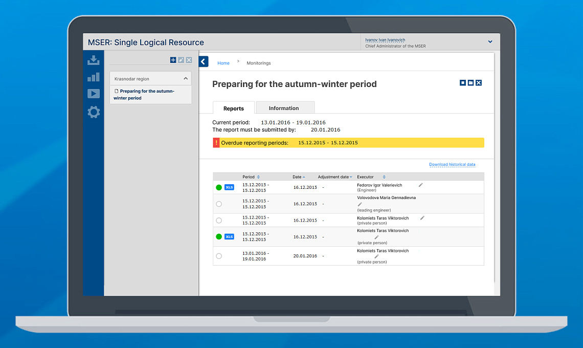
Implement BI analytics for quick access to statistics information.
Implementation
We delivered tailored map visualization solutions based on Microsoft Silverlight, Microsoft ASP.NET, PostgreSQL and PostGIS.
Results
Map visualization solution that allows the customer to navigate the city map in a familiar way: use zoom, use a pan, focus on facilities found by a keyword or location, and to get an access to the facility information. Also, the system stores interactive 3D models for some facilities.
Technologies
- C#
- VRML
- PostGIS
- PostgreSQL
- ASP.NET
- SilverLight
Similar cases studies